What does the Space Geodesy Facility do?
The SGF produces geodetic data of the highest precision by three different techniques that are complementary and are co-located on a single site.
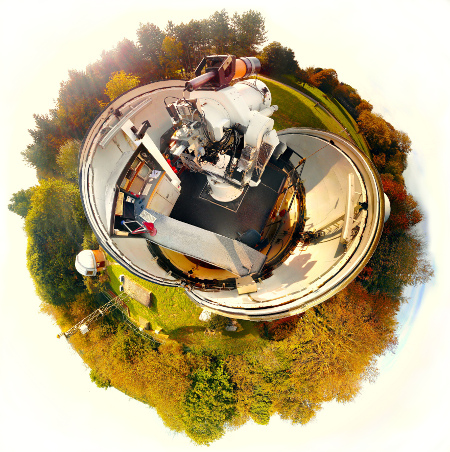
The SGF operates a Satellite Laser Ranging (SLR) station, Global Navigation Satellite Systems (GNSS) sites and a permanently installed Absolute Gravimeter (AG).
In addition, the local site is regularly surveyed for local height variation using a digital levelling device.
The SGF has an ultra-stable active hydrogen maser to provide its own local time, which it uses in the operation of SLR and GNSS.
The backscatter from SLR, due to photons scattering on atmospheric molecules and particles, is monitored by a technique called LiDAR.
The site has also been chosen by the British Geological Survey to host one of its broadband seismometers (HMNX) that automatically contributes in realtime to BGS' British Isles seismic network.
The SGF carries out on-site analysis of the geodetic data it produces and is an ILRS Analysis Centre.