Why do we need Geodesy?
Geodesy is the measurement of the size, shape, gravity field and rotation of the Earth and how these change over time.
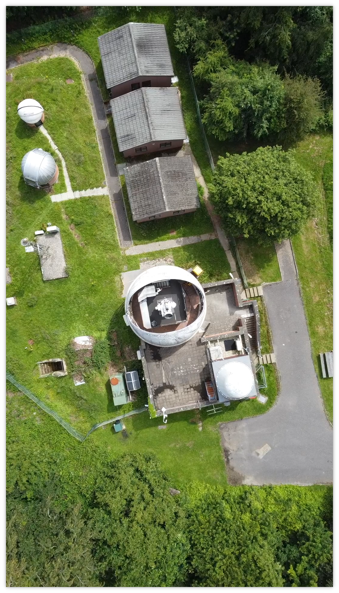
The Space Geodesy Facility, Herstmonceux (SGF) is part of an international network of geodetic observatories making the observations that help unlock the power of precise positioning technologies to enhance both our daily lives and our understanding of the processes driving global change.
To know where you are precisely on the Earth’s surface or in space, you need to be able to measure your position in a common frame of reference or coordinate system. Geodesy creates this reference frame by combining measurements from around the globe, made by multiple observation techniques and analysed by teams of researchers. Together these components form the Global Geodetic Supply Chain, the infrastructure, people and knowledge that operate as a true global collaboration dependant on the contributions of many nations for success and shared freely for the benefit of everyone.
Geodesy provides the underpinning layer of information that lets us know where we are on, under or above the surface of the Earth. This enables us to perform effective disaster and risk management, predicting where problems will happen and enhancing the quality of our response. It provides the accurate positioning and elevation information that allows us to plan and design the buildings and infrastructure of the future. Satellites that are critical to our understanding of the long-term processes influencing the climate rely on geodesy to provide the precise orbits that locate their observations in space and on the ground.
By measuring gravity and how it changes over time and place, geodesy can reveal the way mass is distributed and transported around the globe. For example, tectonic movement, polar ice melting or at a smaller scale groundwater depletion can all be monitored and their impacts assessed by watching the effect they have on gravity.
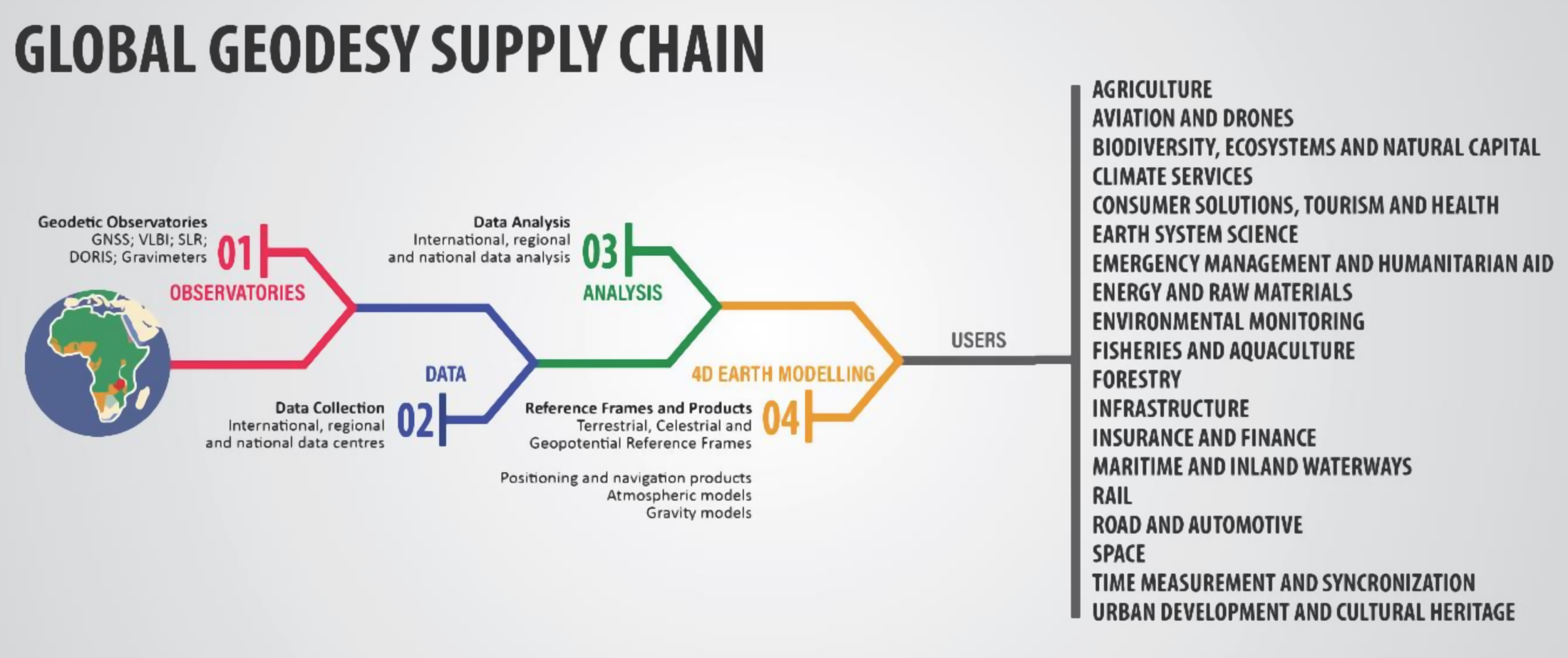
Credit: UN Global Geodetic Centre of Excellence (UN-GGCE)
Modern life depends on position, navigation and timing (PNT) technologies to an ever-increasing extent. From satellite navigation in our phones, to monitoring sea level and flooding, even precise timing of financial transactions, these systems are embedded in our economies and daily lives. But what isn’t widely understood is how these critical capabilities rely on the reference frame and geodesy. As a response to this gap in understanding the UN agencies with responsibility for governance and oversight of the Global Geodetic Supply Chain (GGSC) have published a report highlighting the risks to our PNT technologies from a lack of investment in Geodesy. For more information on this hidden risk see here.
For more information on Geodesy and why it is important take a look at the International Association of Geodesy (IAG) website. Details of the individual observations and instruments operated at SGF can be found throughout the website. But for a global overview of all the geodetic measurements that contribute to furthering our understanding see the Global Geodetic Observing System (GGOS) website.