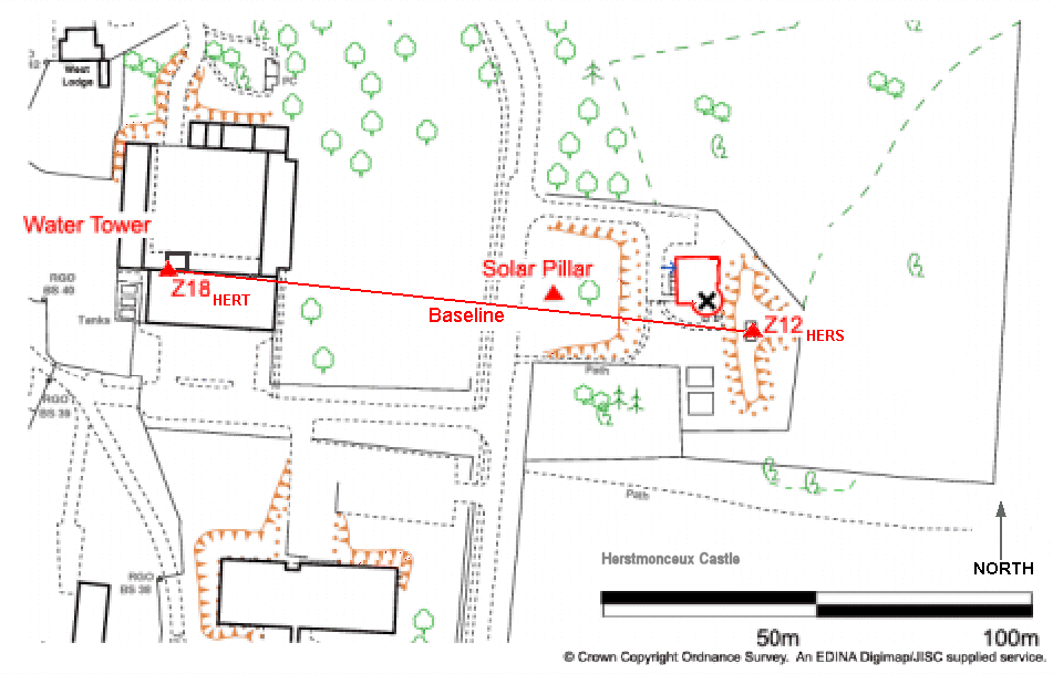
HERT
is approximately 136m from HERS. The two
receivers are therefore tracking the same satellites at the same time
and are under identical atmospheric, tidal and plate motion conditions.
This situation allows
a very accurate inter-site baseline to be
calculated each day.
A Third GPS site was installed in November 2007 on the Solar Pillar
inbetween the two SGF sites. This is named SOLA.
|

Image produced from the Ordnance Survey Get-a-map service. Image
reproduced with kind permission of Ordnance Survey and Ordnance Survey
of Northern Ireland.
|


