 |
 |
 |
 |
 |
|
Water Table Analysis |
 |
 |
 |
 |
 |
|
Water Table Analysis |
 |
|
 |
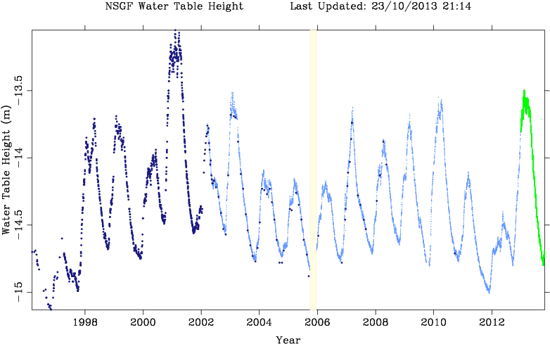
*Manual *Automatic *Latest The NSGF sits upon a
deep clay bed. There is evidence in the geodetic
results that
the height
of the site varies seasonally with changing
ground-water loading as
measured
by the depth of the local water table.
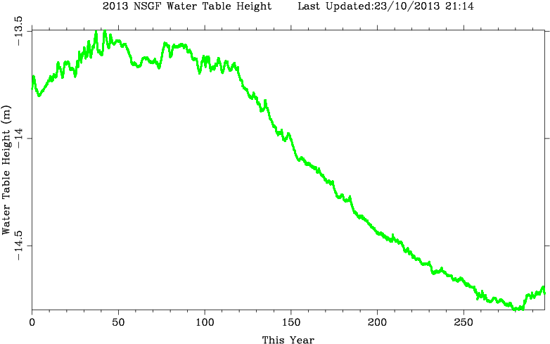
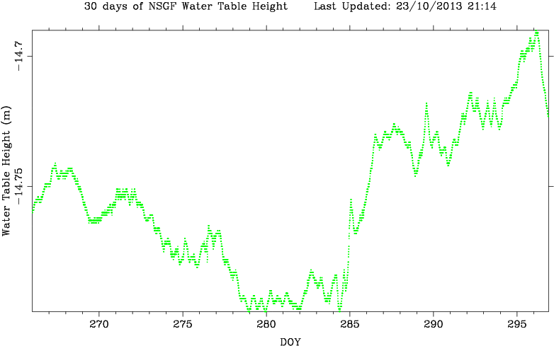
This depth has been closely monitored by daily readings taken from an onsite borehole, which was drilled in 1996. The measurements were initially made once a day by hand, but from early 2002 the depth has been measured automatically and many times a day using an electronic pressure sensor. This device malfunctioned, indicated by the blue strip, at the end of 2005 and was replaced. It is very clear from the first graph that for the three years 2004, 2005 and 2006 the water table level has been very low, the winter peaks being much deeper (water table not being replenished to the same extent) than for the previous six years. This observation agrees well of course with the general near-drought conditions that were reported in the UK, primarily in the southern counties, during 2005-2006. However, heavy and persistent rain in late 2006 and early 2007 replenished the water table fairly rapidly, and 2006/2007 winter levels are seen to have been higher than at any time since early 2003. |
 |
|
 |
|
Go back to SGF main page |
|