|

|

|

|

|
|
Introduction |

|

|

|

|

|
|
Introduction |
 Located
at Herstmonceux is a high-precision satellite laser ranging
(SLR)
system, an Ashtech Z-12 geodetic GPS receiver and an
Ashtech Z-18, dual frequency, joint GPS/GLONASS receiver.
The Ashtech receivers are in almost continuous operation, and the
generally good weather along the South Coast of the UK means that on
average during the year the SLR system observes some 45% of the
available satellite
passes both by day and at night. Located
at Herstmonceux is a high-precision satellite laser ranging
(SLR)
system, an Ashtech Z-12 geodetic GPS receiver and an
Ashtech Z-18, dual frequency, joint GPS/GLONASS receiver.
The Ashtech receivers are in almost continuous operation, and the
generally good weather along the South Coast of the UK means that on
average during the year the SLR system observes some 45% of the
available satellite
passes both by day and at night.
Observations from these three techniques are carried out in support of many UK and International programmes of research in geodesy and geodynamics. The Ashtech Z-12 GPS
receiver daily
and hourly
contributes 30-second data to the International GPS Service (IGS)
in
support of this
global geodetic service, whilst the Ashtech Z-18 routinely collects and
distributes daily 30-second data on GPS and GLONASS satellites to the
IGS's
IGLOS Pilot Project
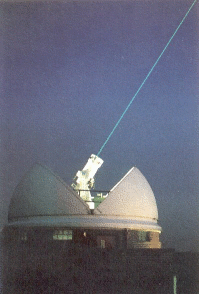
Processed SLR data is rapidly deposited at NASA's Crustal Dynamics Data Information Service, (CDDIS) and at the Eurolas Data Centre (EDC), in support of the International Laser Ranging Service (ILRS). Through these agencies the observations from the network are available to the research community usually within 1 or 2 hours of the observations being made. A snapshot of the work of the Facility, in the context of support for UK Earth Observation science, is given here We are also constructing a virtual tour of the Facility which you can see here The Satellite Laser Ranging SystemLaser ranging is one of the most accurate techniques available for observing the orbits of artificial satellites. Although it can only be used with satellites carrying retro-reflectors, these devices are entirely passive, long-lasting, light and small, and so are relatively easy to fit to satellites whose precise positions need to be known. Sometimes the results may be needed for one specific purpose, but most satellite ranging observations can be used in many different, but inter-related, investigations. The satellite laser ranging system (SLR) at Herstmonceux has been in regular operation since October 1983 and is now recognized as one of the most effective installations of its kind in the world.

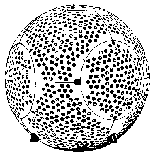
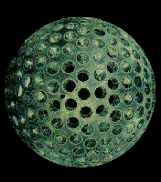
 The technique uses time-of-flight measurements with short pulses of light to determine the range to a satellite as it moves in orbit around the Earth. The light pulses come from a pulsed Nyodymium-YAG laser and are beamed at the satellite. The retro-reflectors work like `cat's eyes' and reflect the light they receive back to the receiving telescope. From the pulse of (one hundred thousand million million) photons emitted towards the satellite only about one is recorded by the receiver in every 5 to 10 shots, where the repetition rate is 10 shots per second. The principle for determining distance is the same as that of radar except that light, rather than radio waves, is used. Because a narrow pass-band filter is used to cut out the light from the sky, the equipment can work both by day and night, provided that the skies are clear. Its single-shot precision of about 1 centimetre is typical of the best fifteen of some 30 systems worldwide that now form the ILRS tracking network. Checking and setting up of the system is done by ranging to local targets, and the observations are dated to within 1 millionth of a second so that they may be properly combined in analyses with others obtained elsewhere. A single LAGEOS satellite pass, lasting up to 40 minutes, may yield more than 5000 returns. Each return corresponds to the detection of only one photon. Ranging accuracy is ultimately limited by the correction for the slower speed of light through the atmosphere. This correction amounts to about 2 metres at the zenith and is computed from meteorological data; the estimated uncertainty of the model is about 1 centimetre. It is also recognised however, that in order to refer the range observations to the centre-of-mass of the satellites care must be taken to understand the characteristics of the observing system. For instance, a system such as the Herstmonceux system working at the single photon level of return is likely on average to observe 'deeper' into the reflector array than for example a typical NASA system working at high levels of return. This topic is the subject of investigation by the ad-hoc ILRS Signal Processing Working Group. The satellites which are routinely tracked during the 7-days a week and near-twenty-four hours per day operation can be divided into 2 broad classes. The geodynamic satellites are inert, massive spheres designed solely to reflect laser light back to the ranging systems. These objects include Starlette and Stella at heights of around 900km, Ajisai at 1500km, Lageos and Lageos-II at 6000km and Etalon-I and Etalon-II at 19000km.  Etalon Etalon
 Lageos Lageos
The Lageos satellites are observed primarily to obtain information about the rotation of the Earth and the geometry and deformation of its surface, in support of worldwide projects on solid Earth dynamics. In this way, their observations are used to determine and maintain a global, geocentric, reference frame. Observations of Starlette and Stella are of greater significance for studies of the Earth's gravitational field, which is more irregular at lower altitude, and of indirect tidal effects. The Japanese satellite Ajisai and the Russian satellites Etalon I and II are also tracked regularly for similar purposes. The small geodetic satellite GFZ-1 was launched in April 1995 from the MIR space station, and is the lowest satellite ever to be tracked by the laser network. Its four-year mission until its destructive re-entry on 23 June 1999 has helped in the determination of high-order terms in the gravity field, and in atmospheric density studies. Because of the simple geometrical shapes and low area-to-mass ratios designed to minimise the effects of non-gravitational forces on the computation of their orbital motion, the orbits of these geodetic satellites can be computed very accurately. A month-long continuous orbit fitted to laser data from one of the Lageos satellites will typically fit the data to a precision of 2cm, which is approaching the observational precision. Further improvements in the model of the Earth's gravitational field, and in modelling the small non-gravitational forces acting on the satellite, are required to improve the quality of the computed orbits. As a step towards further
improvement in the knowledge of the
high-frequency
components of the field, the first of a new generation of gravity
field missions was launched on July 15, 2000. Called CHAMP,
the Challenging
Minisatellite Payload for Geoscience and Application, the spacecraft
carries GPS
receivers for precise orbit determination and a laser retro-reflector
for
calibration and back-up orbit determination. More information on this
important mission can be found
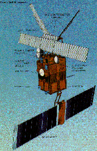
here The second important class of satellites that are observed with high priority are those carrying radar altimeters. For example: ERS-1 (launched by the European Space Agency in July 1991, decommissioned in March 2000), TOPEX/POSEIDON (launched by NASA in August 1992) and ERS-2 (Launched by ESA in April 1995).
 ERS-1 ERS-1
 Topex/Poseidon
 Data from such satellites are making it feasible to study the variations of the height of the surface of the sea, or of the snow and ice in polar regions, and hence to obtain information about ocean currents and eddies, and the profile and structure of the ocean floor. The proper interpretation of such data requires precise knowledge of the orbit which can only be obtained by fitting a detailed model of the forces acting on the satellite to accurate observations. The 3 applications satellites mentioned above are each fitted with retro-reflecting cube-corners; the ERS satellites also have on board an experimental German-built microwave tracking system named the Precise Range and Range-Rate Experiment (PRARE). Unfortunately, the PRARE system on ERS-1 failed shortly after launch, and laser ranging remained the only precise tracking system until ERS-1 itself finally failed in March 2000, after an extremely successful mission. The PRARE system on board ERS-2 is working satisfactorily, but SLR remains the principle tracking system to be used for precise orbit determination and for validating PRARE. The TOPEX/POSEIDON satellite carries, in addition to its large retro-reflector array, French DORIS and US GPS tracking systems. Most of the orbital information made available to users of the altimetric data is derived by a combination of SLR and DORIS observations. A large number of SLR observations of these applications satellites is routinely collected daily from the global tracking network, and used for precise orbital determination as well as for the important task of orbit prediction to enable further observation. Although the geodetic satellites are dense spherical satellites which are not easily `blown off course', this is not true of active satellites for altimetry. They are large, with irregular shapes and in particular drag and solar radiation forces are large and to some degree unpredictable. In order to improve further the links between the SLR-derived global reference frame and that from the GPS system, NASA decided to fit laser retro-reflectors to 2 of the GPS satellites launched in 1993-1994. Because of their height, the objects are difficult targets for the technique, but sufficient data has been obtained from Herstmonceux and from other stations in the network for analyses to be carried out. The SLR telescope also has the potential to perform directional tracking of sunlit satellites at night, regardless of whether they carry retro-reflectors. The telescope drive system is regularly checked by observing stars, and accuracies of a few seconds of arc are possible. Very sensitive cameras and an integrating system have been utilised, making it possible to observe satellites as faint as about magnitude 14. |
 NERC
Space Geodesy Facility Home page